


0451540 - FAIRFIELD Voting District, Carroll County, Georgia
About
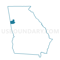
Outline

Summary
| Unique Area Identifier | 560476 |
| Name | 0451540 - FAIRFIELD Voting District |
| County | Carroll County |
| State | Georgia |
| Area (square miles) | 3.31 |
| Land Area (square miles) | 2.93 |
| Water Area (square miles) | 0.38 |
| % of Land Area | 88.55 |
| % of Water Area | 11.45 |
| Latitude of the Internal Point | 33.64343220 |
| Longtitude of the Internal Point | -84.92328830 |
Maps


Graphs
Select a template below for downloading or customizing gragh for 0451540 - FAIRFIELD Voting District, Carroll County, Georgia


Neighbors
Neighoring Voting District (by Name) Neighboring Voting District on the Map
- 0451122 - SANDHILL Voting District, Carroll County, GA
- 0451542 - HULETT Voting District, Carroll County, GA
- 0971271 - EPHESUS BAPTIST CHURCH Voting District, Douglas County, GA